 |
|||||||
 |
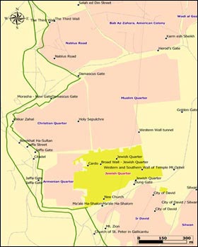
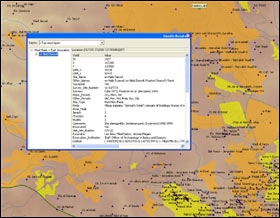
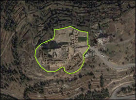
The West Bank and East Jerusalem Archaeological Database Project The West Bank and East Jerusalem archaeological database forms part of an Israeli-Palestinian dialog initiative concerning the standing of archaeological sites and materials in the event of final status negotiations [view the Israeli-Palestinian Cultural Heritage Agreement]. It emerges from the realization that the presentation and control of the past are controversial issues that could be used to derail future negotiations. On the positive side, measures taken to express the joint interest of both sides in the preservation and presentation of historical sites could be used to build confidence and economic cooperation between the parties. Stage I in the our project comprises the compilation of a database on approximately 6000 archaeological sites identified in field surveys and approximately 1200 excavations carried out by the Israeli Civil Administration (about 80%) and by Israeli and overseas institutions (about 20%) [download the full list of excavation licenses]. The sites are being plotted on GIS maps in a manner that will ultimately allow researchers and decision-makers to address specific issues that may interest them: e.g., the location of historically or religiously significant sites (Jewish, Islamic or Christian); the relation between excavated sites and Israeli or Palestinian settlements; archaeological sites affected by the Separation Barrier or bisected by the Green Line; etc. [download our publication: The Present Past of the Israeli-Palestinian Conflict: Israeli Archaelogy in the West Bank and East Jerusalem Since 1967; Israeli Archaeological Activity in the West Bank 1967--2007: A Sourcebook;. interactive map of West Bank archaeological sites ]. The database of archaeological sites includes information such as exact site coordinates, periods of existence, major finds, cultural affiliation and survey references, as well as excavators' names and institutions, license numbers and bibliography for excavated sites. This database is integrated into GIS maps in the form of layers of surveyed and excavated sites, which are added to layers of Jewish and Palestinian settlements, represented by polygons, and other layers such as rivers and roads. Other layers could be generated using the GIS Query option, and thus reveal more specific information, e.g. burial sites, Iron Age sites, etc. All these combined, enable the end-user to examine the relations between the archaeological sites and their urban and natural surroundings. The following screenshots present examples of GIS maps, indicating surveyed or excavated archaeological sites and current settlements, as well as the 'Info' dialog box, which indicates site data retrieved from the database. The photograph of the site Nebi Samwil, defined by a polygon, is an example of future GIS maps enhancements, that will enable to display the archaeological sites as polygons.
The data included in this research was developed with support from the Israeli-Palestinian Archaeology Working Group/Shared Heritage research and negotiation project. Financial support for this project was received by the United States Institute for Peace (Grant USIP-088-04F), the University of Southern California's Center for Religion and Civic Culture and the USC Provost; the Cotsen Institute of Archaeology at UCLA, The S. Daniel Abraham Center, Washington DC and private donors.
Dr. Raphael Greenberg, Project Director |
||||||


