
| |
Back to Research Topics |
|---|
(With Karel Martens, Yodan Rofe, Ariela Kwartler)
| Accessibility is increasingly identified, in both the
academic literature and planning practice, as a key criterion to assess
transport policies and urban land use developments. We proposed a set of high-resolution accessibility measures that directly relates transit-based and car-based accessibility to each other. To estimate the accessibility we developed an Urban.Access, a GIS-based tool to measure accessibility at a high level of resolution. Urban.Access is based on the data available at standard municipality and transport GIS databases: the layers of urban roads, data on urban population distribution, transit lines and transit time-tables. |
 |
 |
|
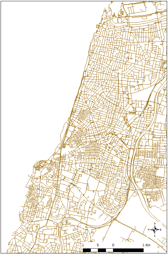
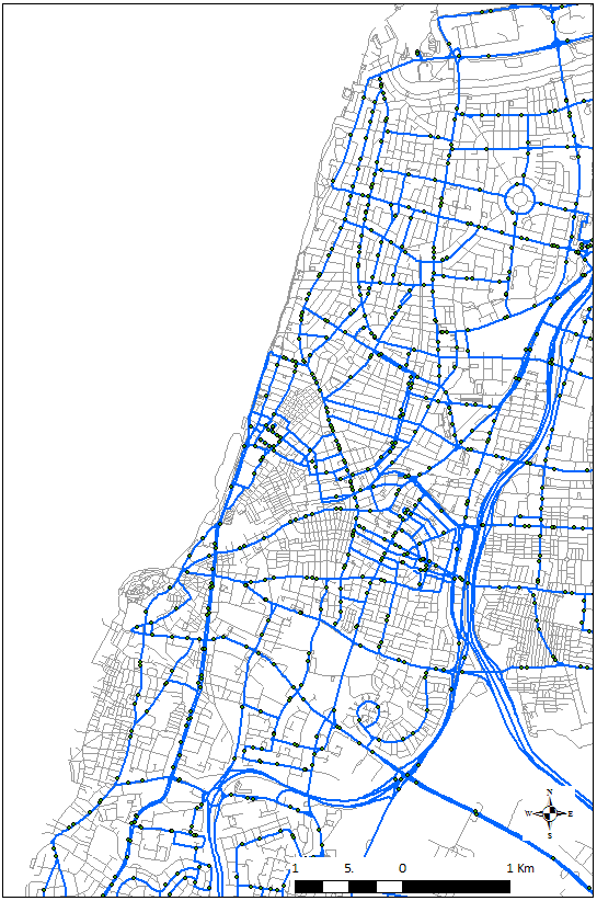
An overview of the road (left) and bus (right) network in Tel Aviv |
|
|
 |
|
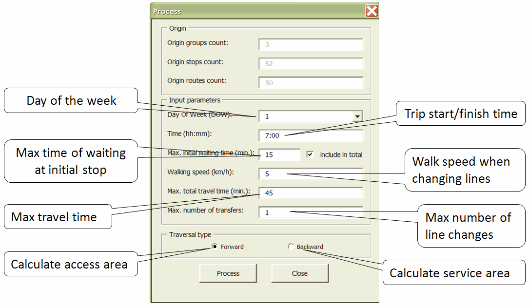
Part of the Urban.Access User
Interface |
The application of Urban.Access to the Tel Aviv region (2.5 mln population, 300 bus lines) shows substantial gaps between car-based and transit-based accessibility throughout the metropolitan area. It also enables to estimate the improvement/decay in accessibility that will be provided by the planned changes in the public transportation in the Tel Aviv metropolitan |
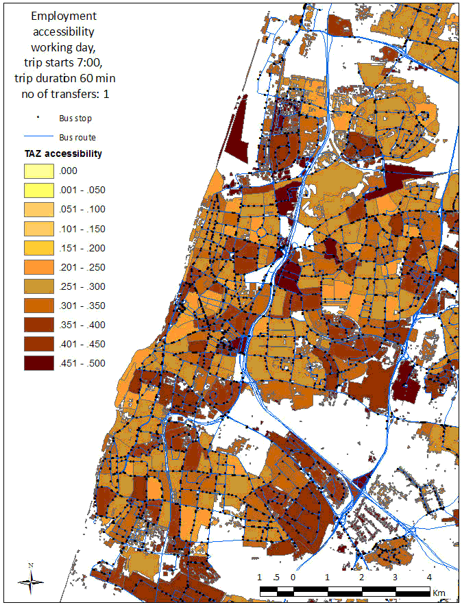 |
The map above presents the gaps between transit-based
and car-based accessibility to employment for the center of Tel-Aviv
metropolitan area, at the resolution of transport activity zones (TAZs),
for transit trips that include one transfer, for a trip starting at 07.00h
and a travel time threshold of 60 minutes. |
| |
Back to Research Topics |
|---|