Image Courtesy of David Slater
Image Courtesy of David Slater
DESERT 2000 is an ongoing multi-national and interdisciplinary project designed to study the crustal structure and geodynamics of the Dead Sea Rift system. The project is coordinated by the GeoForschungsZentrum (GFZ) Potsdam (Germany), in cooperation with Tel Aviv University (Israel), the Hebrew University (Israel), the Geophysical Institute of Israel, the Natural Resources Authority (Jordan), the An-Najah National University (Palestine), and several Universities in Germany.
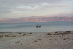
Submarine study of the north end of the northern Dead Sea basin
November, 1999, brought a unique study to the Dead Sea. Mr. Michael Sanders of Mysteries of the Bible raised the interest of Channel 4 (England) and NBC (USA) in a quest for the lost cities of Sodom and Gomorrah. Together they funded the project - brining a two man submersible to the Dead Sea.
A refraction/wide-angle reflection experiment
A seismic
refraction/wide-angle
reflection experiment was carried out in 1993 under the supervision of
Prof. A. Ginzburg and Prof. Z. Ben-Avraham. During the experiment,
which
was done in collaboration with Prof. J. Makris of Hamburg University,
several
OBS were deployed in a north-south line in the northern basin of the
Dead
Sea and portable seismic land stations were placed north and south of
the
lake. The energy source were 20 kg explosive charges.
A paper on
the results of the refraction/wide-angle reflection experiment has been
published by Ginzburg and Ben-Avraham. The main highlights of the
experiments
are the probable detection of salt bodies in the north basin and
the large difference in depth to basement between the north basin,
where
it is about 6 km, and the south basin, where it is about 12 km.
A microseismicity study
After the
seismic
refraction/wide-angle reflection experiment was completed, in 1993, the
OBS were replaced in a grid in the lake and the seismic land stations
were
placed west of the lake for two months to record microseismicity in
this
area. A number of small earthquakes were detected, but in terms of
larger
events, it turned out that our study hit a very quiet period. The study
was done in collaboration with the Seismological Division.
Preliminary
analysis of the seismicity data has been completed as an M.Sc. thesis
by
Jorg Stacker of the University of Hamburg..
A coring campaign in the Sea
A coring
program,
a joint Center and GFZ project, was carried out also in 1993 under the
supervision of Prof. J. Negendank and Prof. Z. Ben-Avraham. A 3.5 Khz
seismic
site survey and extensive logistical effort preceded the coring program.
As it was
expected that hard salt layers would be encountered during the coring
operations,
a Selcore vibration corer was rented from Selantic Subsea Technology,
Norway,
in addition to a Kuhlenberg piston corer. Since deck space was limited
on the only vessel available on the lake (and was therefore
insufficient)
a platform was constructed from pontoons on which the equipment could
be
mounted
and which was towed to the coring locations by the boat. The coring
positions
were selected at locations where the sediments were undisturbed. Ten
cores,
up to 4.5 meters long, were recovered in the southern part of the lake
in water depth up to 315 meters, and four at the mouth of River Jordan.
While the cores were not as long as hoped for, they are the
longest
yet recovered in the Dead Sea. This study yielded much
information
on the sedimentation regime in the Dead Sea and on paleoclimate
variability
in the region during the past 2000 years.
A scientific
technical report by Heim et al. describes the main results of the
cores.
C. Heim has completed his Ph.D. on the material from the cores. A paper
on the results of the analysis was published by Heim et al., in
Naturwissenschaften.
The physical properties of the salt recovered in the cores and of salt
samples from the southern basin of the Dead Sea were investigated at
Stanford
University by Tuntuncu et al. The results of this study have been used
for the interpretation of 3.5 Khz seismic profiles collected in the
Dead
Sea. The comparison of the core stratigraphy and the seismic profiles
has
been investigated by Ben-Avraham et al. and was submitted to JGR.
Environmental history of the Dead Sea area during the past 15,000 years
A coring
campaign
on the western margin of the northern Dead Sea basin was carried out
during
November-December 1997 by a team from GFZ Potsdam under the scientific
leadership of Prof. J. Negendank and Dr. M. Stein of the Hebrew
University.
This work is part of a joint study of the history of the Dead Sea
region
in the Holocene (past 15 kyr) between scientists from the Hebrew
University,
the Geological Survey of Israel, the Dead Sea Research Center and GFZ
Potsdam.
It was partly funded by the German-Israel Foundation (GIF) and the Dead
Sea Research Center.
The sharp
retreat of the Dead Sea in the past 20 years (~0.8 m/y) caused the
formation
of erosional gullies on the plains of retreat and exposed the
post-Lisan
sediments. The drillings were performed in the plains of retreat of the
Dead Sea in several sites (Zeelim terrace; En Geddi Spa; Hever terrace
and En Fescha Nature Reserve). The overall lengths of the drilled tubes
is about 95 m of sediment.
The drilled
sediments consist of laminated aragonite and detritus, thick clastic
layers
of clay and sand. We expect to recover 13-15 kyrs of the Holocene
section.
3.5 Khz seismic profiles
Over the years more than 2000 km profiles were collected in the Dead Sea by Prof. Z. Ben-Avraham and colleagues, the majority of them prior to the establishment of the Center. The seismic profiles present a remarkable detailed, almost three-dimensional, picture of the basin and its western margin. The resolution is about 20 cm and penetration in the deep water portion reaches about 30 m which were probably deposited during the last 8000 years. These data served as basis for a series of studies conducted by Prof. Z. Ben-Avraham and two Post-Doctorate fellows, Dr. T. Niemi from Stanford University and Dr. R. Lubberts from the Free University, Amsterdam. The results of these studies were published in several papers.
Multichannel seismic study of the north basin of the Dead Sea
A
multichannel
seismic survey in the Dead Sea was carried out in 1996 under the
supervision
of Prof. Z. Ben-Avraham and Prof. J. Makris of Hamburg University. The
instruments came from Hamburg University and Russia. Altogether 300 km
of profiles were collected in the western part of the northern basin of
the Dead Sea. For the survey 6 technicians from Russia and 2 from
Germany came to Israel.
In order to
carry out the survey, similarly to what was done in the coring
campaign,
a platform was constructed from patoons on which equipment could
be mounted and which was towed during the survey by the boat. Average
speed
during the seismic profiling was about 2 knots. Processing of the
seismic
data is being done at Tel Aviv University and Hamburg University.
Part of the new data served as a basis for the M.Sc. thesis of
Mr.
Mark Gropius from Hamburg University. At Tel Aviv University the Center
is equipped with a complete set of processing and interpretation
software.
The equipment comprises of two workstations - A Sun Microsystems Sparc
workstation with an ITA seismic processing package and a Silicon
Graphics
Indy workstation equipped with the latest version of the Geodepth
imaging
software made available to the Center by Paradigm Geophysical. The
processing
at Tel Aviv University is done by Prof. A. Ginzburg and Dr. M. Reshef.
Reprocessing and reevaluation of exploration seismic data
These workstations, as well as conventional interpretation techniques, are being used to reevaluate multichannel seismic reflection data acquired in the course of petroleum exploration in the south basin of the Dead Sea. The quality of the data made available to the Center by the Israel Oil Corp. is generally good, particularly those data obtained in the course of the more recent surveys. The interpretation of these data is being carried out (in two separate projects) by Ms. Birgitte Larsen, as part of her Ph.D. research and Mr. Haim Shulman and will give a good and detailed insight into the seismic stratigraphy and sedimentation history of the basin fill. It is expected that the reprocessing and depth imaging of key lines carried out by Prof. A. Ginzburg will enhance the mapping of the salt structures within the fill as well as the structure of the pre-fill basement underlying the Dead Sea.
Evaluation of potential field and thermal data from the Dead Sea
A project combining interpretation of gravity magnetic and thermal data from the Dead Sea and its surrounding area was carried out by Dr. L. Eppelbaum. In the course of the work, a combined 3-D interpretation of gravity and magnetic data was compared with the thermal data. New models reflecting the deep structure and temperatures under the Dead Sea basin were constructed.
Geographic information system (GIS) for the Dead Sea
A GIS model
for the Dead Sea was constructed by Dr. Gideon Tibor. At present it
incorporates
part of the available geophysical and geological data from the area,
including
bathymetry and topography; satellite images; gravity field; magnetic
field;
location maps of multichannel and single channel surveys in the
northern
basin of the Dead Sea; location and description of cores from the Dead
Sea. Other available data such as location of drill holes on land
and location of multichannel surveys in the southern basin will be
incorporated
into the model.
Much data
from the eastern side are slowly becoming available. They will be
added to the model which will be accessible to everybody working in
this
area.
Hyperspectral imaging
As part of an ongoing research program with the GFZ, Potsdam, Germany, under the supervision of Dr. H. Kaufmann, a unique data set of hyperspectral images along the Dead Sea rift was collected in collaboration with the Center which also provided partial financial support. This set includes data from two recent campaigns over the Dead Sea basin (CASI - April 1997, DAIS - August 1997) and over the Sea of Galilee (CASI - 1997). The advantage of hyperspectral data lies in its high spatial and spectral resolution allowing for better quantitative analysis of the research area. The DIAS campaign offered a special chance to collaborate with the German Space Agency (DLR). The Sea of Galilee data were used as the basis for a M.Sc. research program of Mr. M. Lazar on the monitoring of the suspended matter in the water of the lake, while the Dead Sea data provide information for a Ph.D. research program of Mr. A. Zock on the distribution of evaporitic minerals in the Lisan area and for a M.Sc. research program of Mr. M. Schodlok of the Free University Berlin on the geology of Mount Sodom.
Aerosol transport and sedimentation over the Dead Sea Valley
The study of the formation of a haze layer in the Dead Sea Valley, was started under the leadership of Prof. Zev Levin. It serves as the Ph.D. research program of Mr. H. Gershon. A haze layer which is formed almost daily in the Dead Sea Valley, reduces the amount of solar radiation reaching the surface and decreases the evaporation rate from the Dead Sea. The causes of this haze layer are investigated by the use of: 1) a numerical model of airflow from the Mediterranean coast to the Dead Sea area. 2) a haze growth model incorporating the chemical composition of the particles and the moisture resulting from evaporation of the Dead Sea. 3) through the use of ground based instruments and airborne measurements conducted to measure the aerosol composition and size distribution as well as temperature and humidity. The results will be used in evaluating the effect of the haze on the incoming radiation and the potential cooling effect of these particles. Results obtained so far indicate that air and particles from the pollution sources along the Mediterranean coast are transported into the Dead Sea Valley by the sea breeze. In the Valley, internal circulation produces an inversion layer at a height of about 700m above sea surface (300 ASL). This inversion traps the particles during the day, causes them to absorb water vapor and to produce the observed haze layer. The particles are removed by winds in the late afternoon.
Summary of main research results
The main results of the research activities in the Dead Sea Research Center are:
* The basement
configuration
under the Dead Sea Basin as mapped by seismic
refraction
is markedly different in the North basin and South basin; in the North
basin,
the basement is 6 km deep, while in the South basin it is 12 km deep.
* The Lynch Straits,
in the divide area between the North and South basins, is at
present
the most seismically active.
* As indicated by
the cores from the North basin, there were pronounced climatic
fluctuations
in the region during the past 2000 years, which are reflected in the
depositional
pattern in the lake. For example, 2000 years ago the area was more
humid
than today.
* The
sedimentary
sequence of the top 4 m in the deep water part of the lake is
composed
of alternating layers of salt and marl which are related to the
hydrological
conditions. The salt sequences were precipitated during periods of
higher
aridity. The marl sequence is composed of a series of seasonally
laminated
evaporitic
and detrital layers deposited during periods of higher humidity.
* Seismic velocities
in the Dead Sea salt are depth dependent.
* The North basin
is bounded by active faults and the intervening sediments are
relatively
undeformed.
* The western
longitudinal
fault at the North basin is divided into several segments
with
different orientations.
* The Jordan River
delta has experienced several slumping episodes, the last one
occurred
as a result of the 1927 earthquake.
* GPS measurements
suggest that during the period July 1996 - July 1997 there was
no
significant motion between the two sides of the Dead Sea transform.
* Air and particles
from the pollution sources along the Mediterranean coast are
transported
into the Dead Sea Valley by the sea breeze.